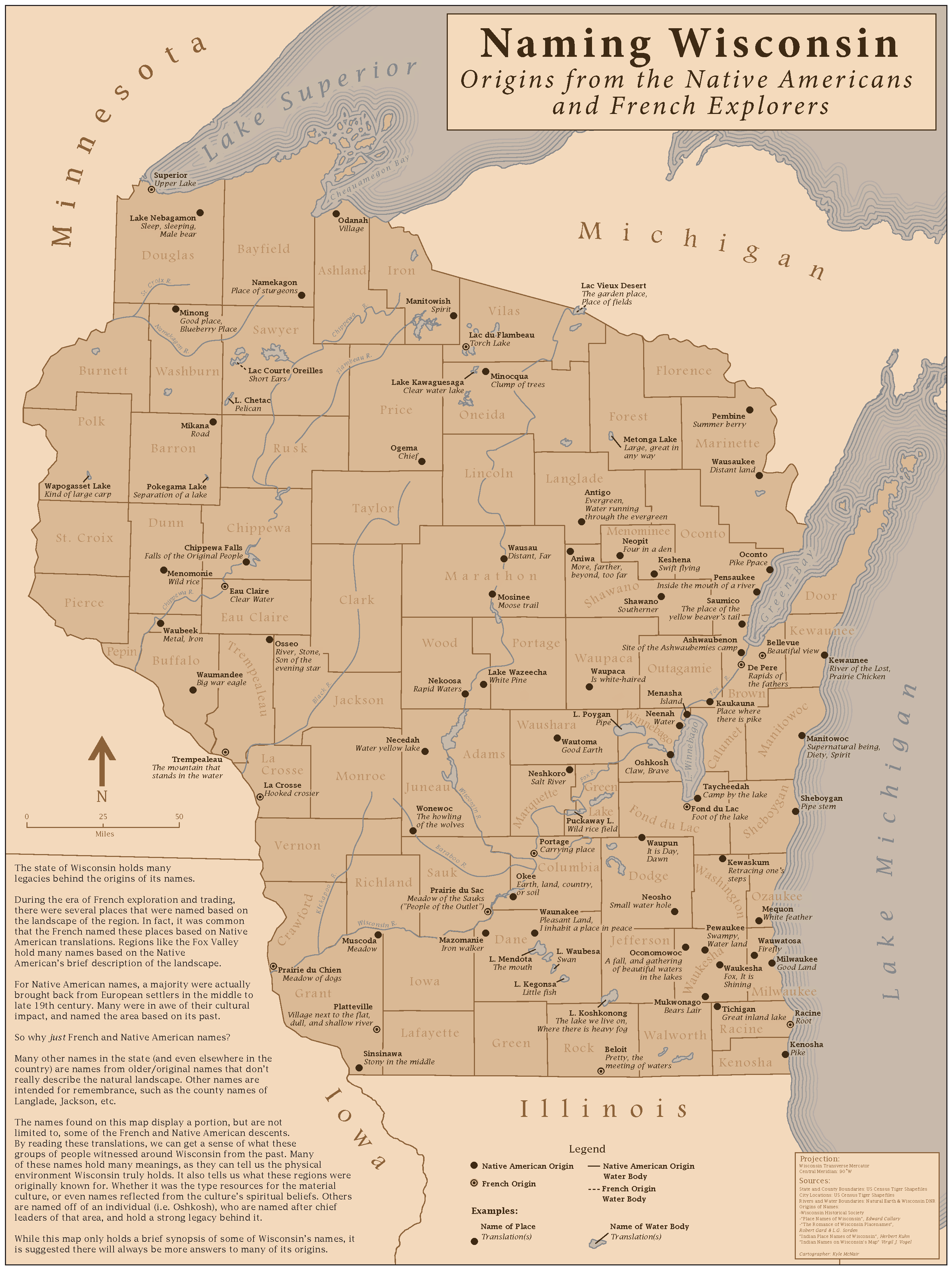
When looking at a modern map of Wisconsin, you will see so many names and places from several backgrounds. Below is a map of Wisconsin's place names from the French exploration and Native American era. Throughout this project, I tried to fit as much content as possible. A lot of careful research was used during the process, as I wanted to ensure the information being mapped was as up-to-date and as accurate as possible.
Map was created using Adobe Illustrator and Photoshop
Click here to see the full version.
