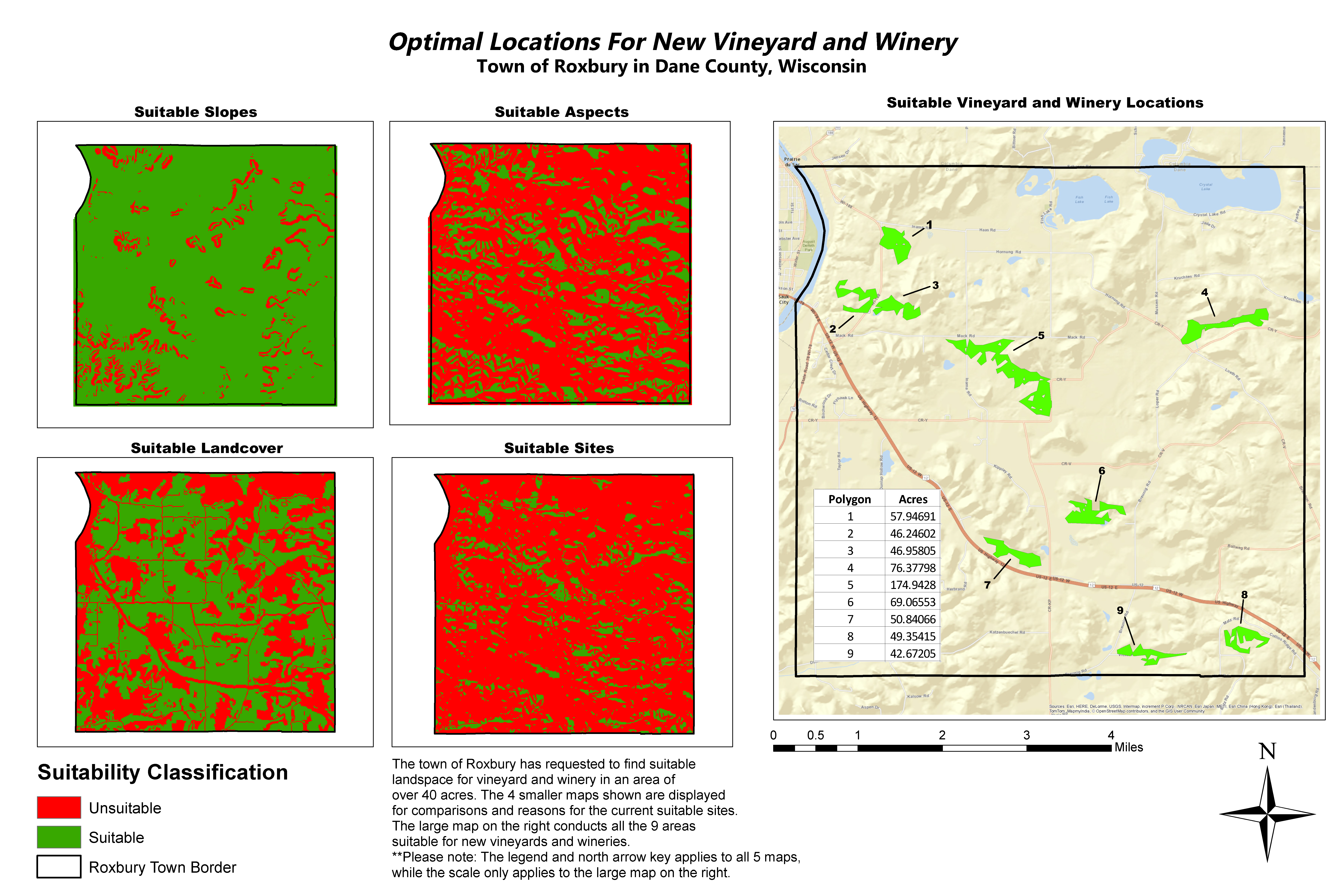
In one of my advanced GIS courses at University of Wisconsin - Stevens Point, we were assigned to find a new vineyard and winery in the town of Roxbury, Dane County, Wisconsin. Many factors are brought in order to provide the most suitable lands for the vineyards.
The primary factors for the landscape being examined is its slopes, land cover, and an aspect. This means all of the features will be raster data type. For a suitable slope, the slope can not have a slope steeper than 14 degrees. An aspect is the angle of a down slope. For this area, the aspect can only be between 157.5 degrees and 247.5 degrees. Of course, an elevation raster model will be needed in order to create a slope and aspect. For land cover, the best class is agricultural land. With all of these factors set to the most applicable setting, the raster calculator can be used. Since raster can be reclassified, the values will be relcassified as integer values, any of these factors can have a 1 value of being suitable, or "0" value for non-suitable. Thus, precise results from the raster calculator are given.
Suitable sites are determined around the county. However, only 9 locations were chosen because they had an area of over 40 acres. Higher area of suitable vineyard sites are more beneficial for wineries.
